


What began as a muddy crossing on the edge of Brisbane has evolved into one of the city’s most enduring suburban centres. The Stones Corner Heritage Trail traces this remarkable transformation through a 2.3-kilometre self-guided walk, uncovering the people, businesses and wartime landmarks that helped shape the precinct over more than a century. From Burnett Swamp and horse-drawn drays to electric trams, department stores and community halls, the trail offers a fascinating glimpse into how Stones Corner grew from rural outpost to thriving urban hub.
Read: Stones Corner: A Rising Star for Downsizers and Rightsizers in Brisbane
Burnett Swamp Bridge
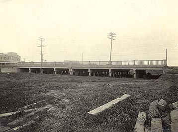

Before shops and sidewalks lined Logan Road, this area was an open wetland known as Burnett Swamp. Named after explorer James Charles Burnett, the swamp was crossed by a key track used by drays and flocks heading to Brisbane. This rudimentary route eventually became Logan Road, setting the foundation for Stones Corner’s future.
Thomason’s Buildings (former)
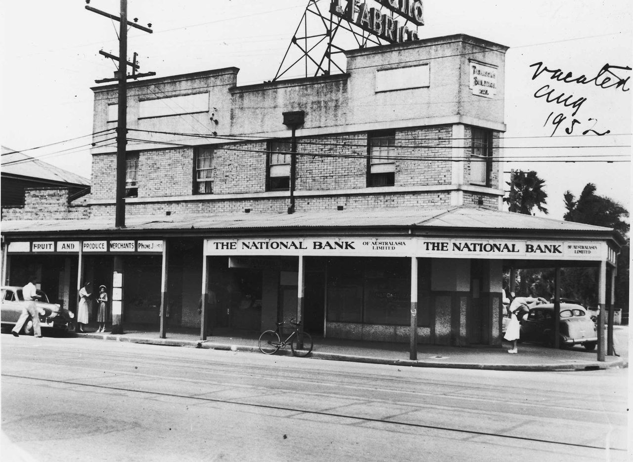
Built in 1925, these commercial buildings were commissioned by pharmacist and entrepreneur Thomas Watson Thomason. Positioned on the corner of Cleveland Street and Logan Road, they catered to the area’s booming retail scene and marked a turning point in the suburb’s economic prosperity.
Thomason Brothers & Co Buildings (former)
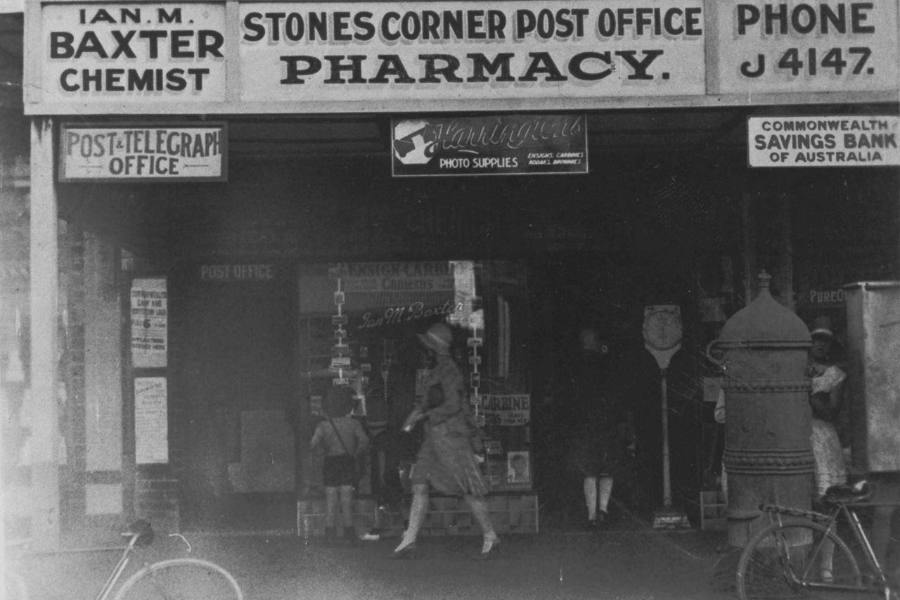
Located further down Logan Road, these 1888 buildings were part of Thomason’s expanding chain of pharmacies. By the 1890s, Stones Corner had become a retail hotspot, complete with banks, a hotel, and a post office—Thomason’s pharmacy at its heart.
Stones Corner Air Raid Shelter
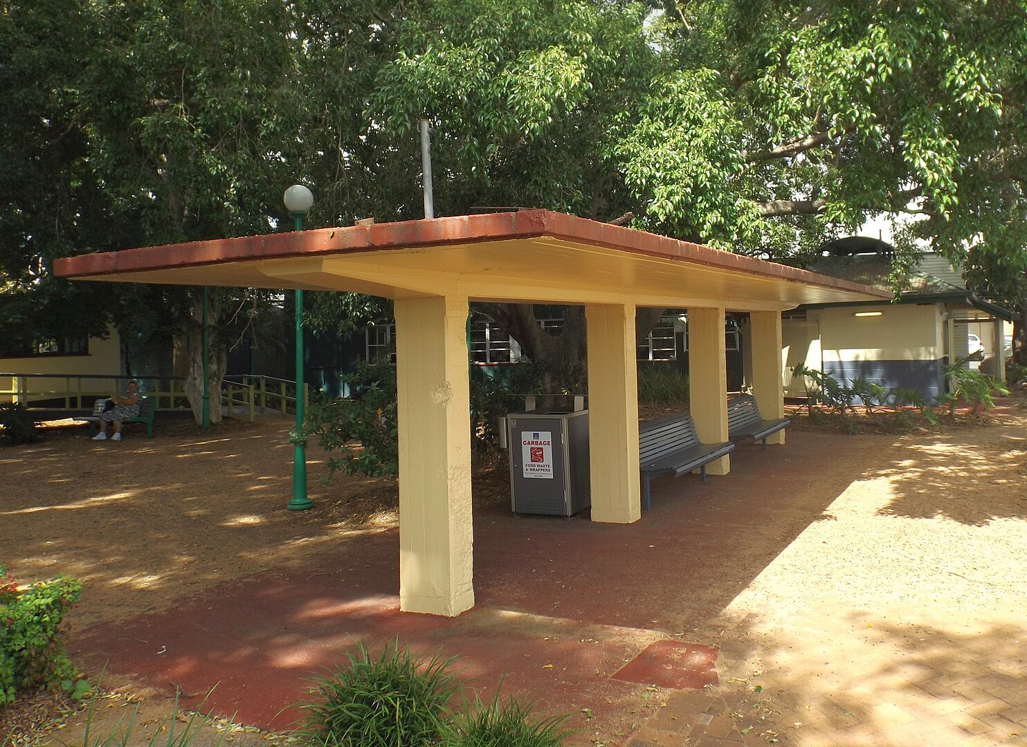


Constructed in 1942, this shelter was built to protect locals during World War II. After the war, its sturdy design allowed it to be repurposed into a public bus shelter, reflecting the community’s optimism and resourcefulness even in times of conflict.
Commonwealth Bank of Australia (former)
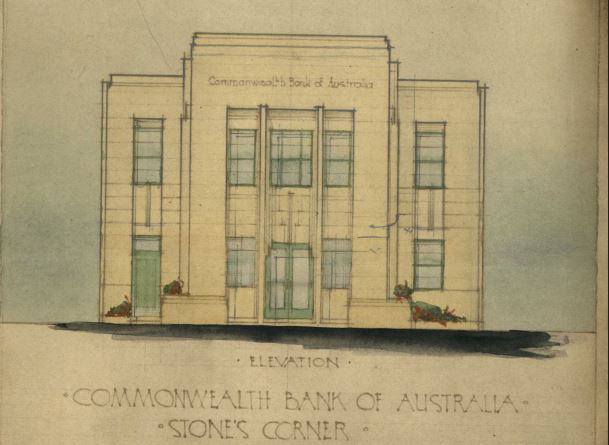
Opened in 1939, this purpose-built bank symbolised Stones Corner’s financial maturity. Designed in the Stripped Classical style by Commonwealth Government architect Edwin Hubert Henderson, the building was a response to the suburb’s growing demand for financial services.
Penneys Building

As department stores rose to prominence in the early 20th century, Penneys brought the “one-stop shop” experience to Stones Corner. It represented the rise of middle-class consumer culture, offering everything from fashion to household goods under one roof.
The High Street
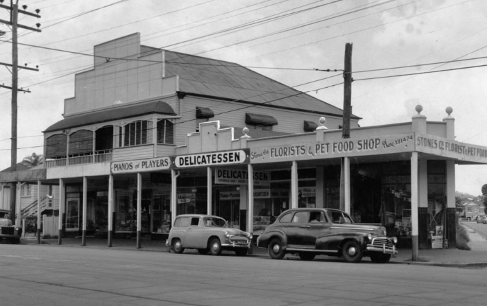
Logan Road was the original high street of Stones Corner, where 19th-century residents could visit a butcher, grocer, bootmaker, and even a saddler. The area was a hive of essential services, enabling newcomers to settle and thrive.
Salvation Army Hall (former)

Originally the Oddfellows’ Hall, this 1890 building served as a key community venue. Run by a fraternal society known for mutual aid and moral development, it offered social events and support to its members, strengthening community bonds in early Stones Corner.
Coorparoo Police Station
This modest police outpost at 19 Knowsley Street witnessed its share of drama. Reports from 1889 detail crimes from gang harassment to a meticulously planned safe-cracking heist, painting a picture of a suburb grappling with the challenges of rapid growth.
Coorparoo Substation No. 210
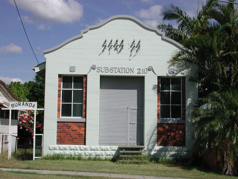
The arrival of electric trams in 1902 did more than ease travel—it brought power to the suburb. By 1920, Stones Corner celebrated the switch-on of electric street lights, a sign of modernity fuelled by the infrastructure surrounding the tramlines.
Langlands Park
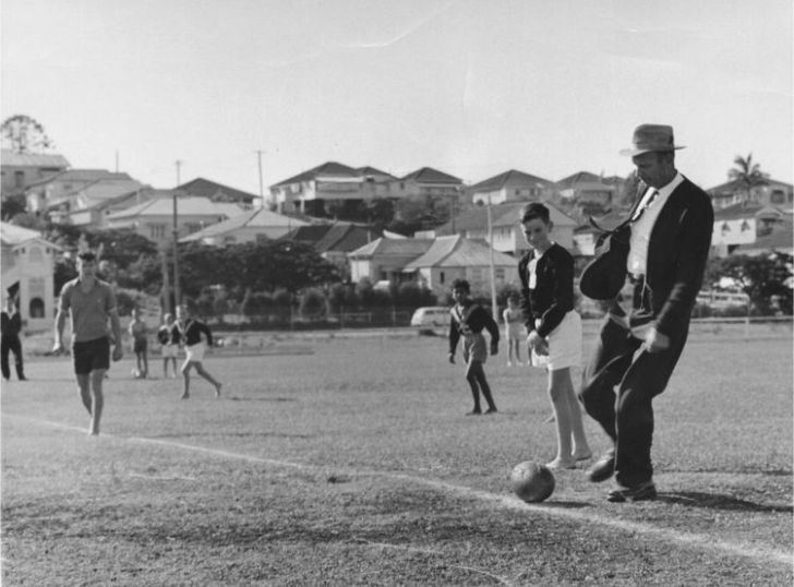
Once part of the Langlands Estate, this area transitioned from pastoral stockyard to a recreational hub. As houses replaced paddocks in the 1890s, the need for green space grew—leading to the creation of Langlands Park, now a cherished community venue.
Read: First Look: Brisbane Releases Stones Corner Suburban Renewal Precinct Plans

From muddy crossings and chemist shops to banks, department stores and electric lights, the Stones Corner Heritage Trail offers a vivid look at a suburb shaped by ambition, enterprise and community spirit. Whether you’re a history buff or curious local, this walk reveals how one corner of Brisbane came to play such a pivotal role in the city’s story.
Published 2-November-2025
Updated 28-April-2026